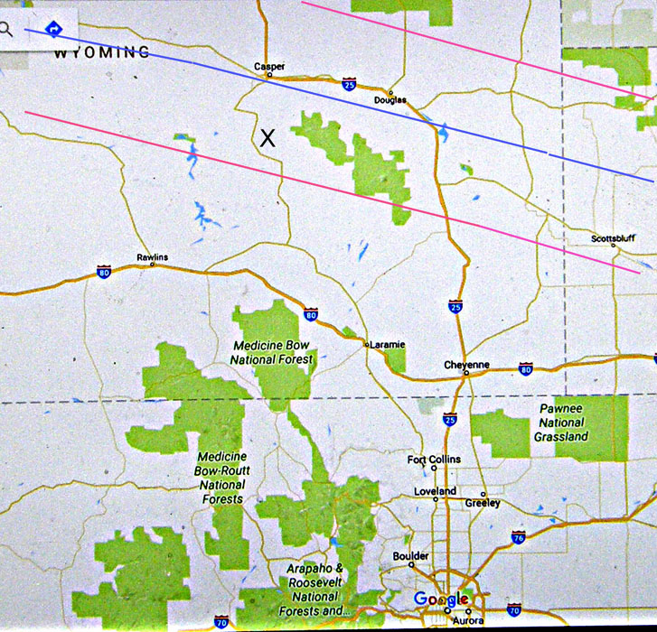
Map showing the part of Colorado where Chris and Penny are living at the moment (near Boulder) and the part of Wyoming where theTotal Solar Eclipse took place on 21st August 2017. The blue line is the centre line of the eclipse and the red lines are the limits of the area of totality. Chris and I originally planned to view the eclipse near the reservoir in Glendo State Park where Interstate 25 meets the eclipse centre line. We set out at 4.30 am but by 7 the traffic was so heavy that we left the I25 at Fort Collins and headed via Laramie towards Casper. We set up at the point marked X, arriving about 10am, 20 minutes before start of the partial phase.